Proposed Trans Mountain (formerly Kinder Morgan) Pipeline Route Maps
This page contains maps related to the Kinder Morgan Trans Mountain Pipeline running from Edmonton, AB to Vancouver, BC. New maps will be added as they become available.NOTE: The PIPE-UP Network makes these maps available for general interest only and takes no responsibility for their accuracy or use.
Click Links below to view maps
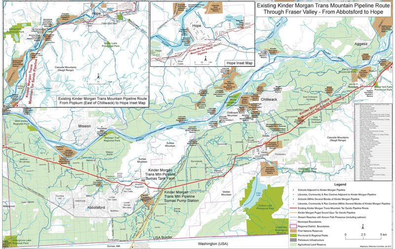
Trans Mountain Pipeline in the FRASER VALLEY
Detailed community-level map including schools, waterways and endangered wildlife habitat along route

(click image to view PDF)
Trans Mountain Pipeline in METRO VANCOUVER
Detailed community-level map including schools, waterways and endangered wildlife habitat along route
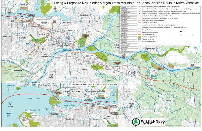
(click image to view PDF)
Existing Trans Mountain Pipeline Route – HOPE to ABBOTSFORD
(click image to view PDF)
HOPE 1
HOPE 2
POPKUM – FRASER VALLEY AREA D
HOPE TO CHILLIWACK
CHILLIWACK 1
CHILLIWACK 2
ABBOTSFORD 1
ABBOTSFORD 2
LANGLEY
SURREY 1
SURREY 2
SURREY 3
COQUITLAM
BURNABY 1
BURNABY 2